This software inserts and remove the tags exif latitude, longitude and altitude in jpeg, tiff and png images performing the geo-positioning of images, it uses tracklogs of GPS devices.
Features
- Handles tags EXIF / IPTC in images: jpeg, png, tiff, pgf, psd.
- Add latitude, longitude and altitude to images files.
- Remove latitude, longitude and altitude from images files.
- Positioning geographically imagens using tracklogs GPS.
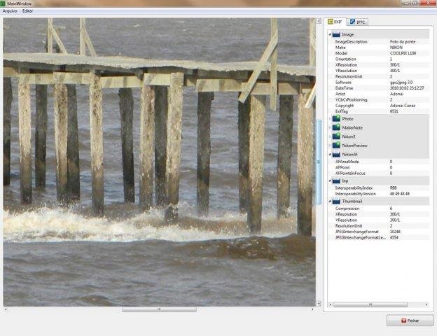
- Show all EXIF, IPTC and XMP informations.
Project Samples

Categories
Metadata EditorsLicense
GNU General Public License version 3.0 (GPLv3)Follow gps2jpeg
Other Useful Business Software
Loan management software that makes it easy.
Bryt Software is ideal for lending professionals who are looking for a feature rich loan management system that is intuitive and easy to use. We are 100% cloud-based, software as a service. We believe in providing our customers with fair and honest pricing. Our monthly fees are based on your number of users and we have a minimal implementation charge.
Rate This Project
Login To Rate This Project
User Reviews
Be the first to post a review of gps2jpeg!
